Things are heating up fast in the City of Toronto this afternoon after what might be the coldest three-week-long stretch we've experienced in years.
Gone is the Polar Vortex that ruined your life for most of January. Now is the time of a "February thaw" that, while short lived, will melt a great deal of the snow that's been accumulating all over sidewalks, roads and buildings.
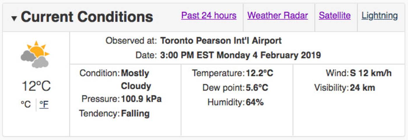
 Environment Canada is observing temperatures of 12 C at Toronto's Pearson International Airport as of 3 p.m. on Monday afternoon—even warmer in some other parts of Southern Ontario.
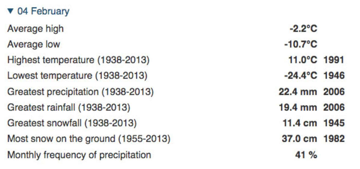
The weather agency's averages and extremes index shows that the highest-ever recorded temperature in Toronto on this date was 11 C in 1991. Meteorologists have recorded an average high of -2.2 C on February 4 since 1938.
 Get out and enjoy it while you can. A rain system is moving in and temperatures are expected to dip back down to - 10 C by Tuesday night.
By Wednesday morning, we're looking at freezing rain with a chance of snow followed by more violent ups and downs on the thermometer. So keep your pants on, guys. For real.
Seen for the 1st time today in Toronto temperature above 0 and i see someone out in shorts #the6ix
— Justin Time (@SubwayOperator) February 4, 2019
"An active pattern with a lot of arctic air" will hover nearby for the next couple of weeks, says Weather Network meteorologist Dr. Doug Gilham.
"The key will be where the dividing line and storm track are for next week and beyond... Next system to watch is late Sunday and Sunday night."
by Lauren O'Neil via blogTO

No comments:
Post a Comment