The 2018 edition of the Scotiabank Toronto Waterfront Marathon returns Sunday October 21. The annual event that also includes a half marathon and 5k brings with it major road closures all over the city.
Here's what you need to know to navigate around the city this weekend.
Course map
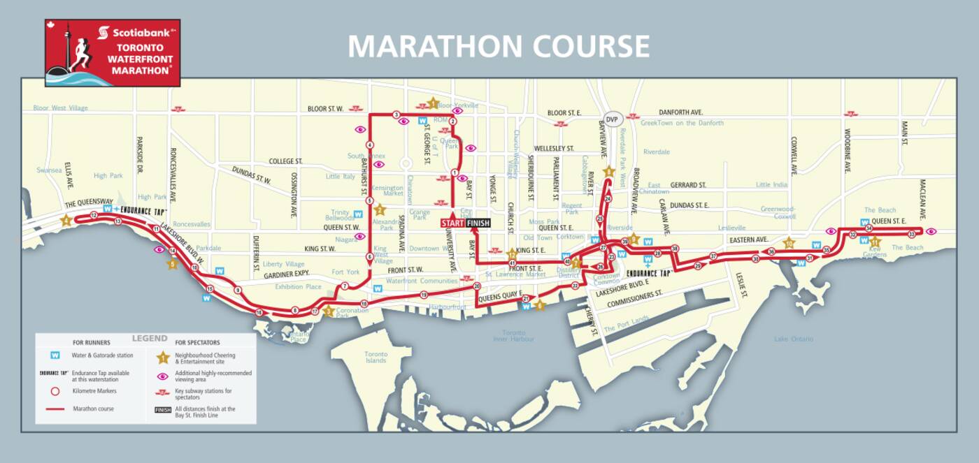
Whether you're a runner or a spectator, the map below details all the route info for this weekend. You can find a high resolution version here.

This map charts out the entire route of the 2018 Toronto Waterfront Marathon.
Spectator areas
While you can watch the run from vantage points all across the route, if you're looking for something a bit more exciting, there are designated neighbourhood and cheering entertainment centres throughout the course. They can be found at the following locations.
- University of Toronto (after 2.5K) from 8:50 a.m. to 9:45 a.m.
- Alexandra Park (after 5K) from 8:55 a.m. to 10:15 a.m.
- Liberty Village/King West (after 7.5K & 17K) from 8:05 a.m. to 12:15 p.m.
- Swansea/Bloor West/High Park (after 12.5K) from 9:15 a.m. to 11:30 a.m.
- Parkdale/Roncesvalles (after 11K & 14K) from 9 a.m. to 11:45 a.m.
- Harbourfront (halfway) from 9:45 a.m. to 12:30 p.m.
- Corktown (after 26K & 39K) from 10 a.m. to 2:45 p.m.
- Cabbagetown (after 25K) from 9:55 a.m. to 1:30 p.m.
- GreekTown (after 27K & 38K) from 10 a.m. to 2:40 p.m.
- Leslieville/South Riverside (after 30K & 35K) from 10:10 a.m. to 2:30 p.m.
- The Beach (after 32K & 34K) from 10:15 a.m. to 2:15 p.m.
- St. Lawrence (after 41K) from 10:45 a.m. to 3 p.m.
Road closures
The Scotiabank Toronto Waterfront Marathon has more road closures than any event in the city, but fortunately for people making their way around downtown, many of them will be lifted by late Sunday afternoon.
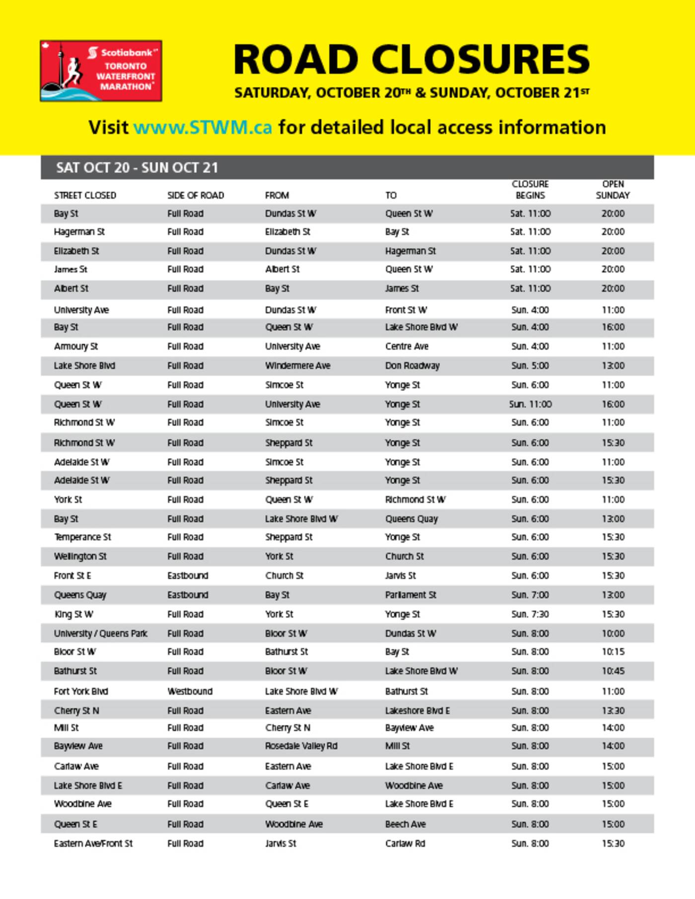
Key areas of the run will, however, be closed from Saturday to Sunday evening. The chart below details all the closures taking place.

Displayed here is a full list of road closures taking place this weekend for the Toronto Waterfront Marathon.
For more information visit the Toronto Waterfront Marathon website. Also here's an interactive map that is useful for tracking participants and charting road closures.
by Jaclyn Skrobacky via blogTO

No comments:
Post a Comment