Don't let those gorgeous rays sunshine streaming through your window this morning fool you: Toronto has yet to come out of the darkness, despite a few flashes of light here and there.
Winter and spring remain locked in a battle for control of Southern Ontario as we near the end of March, with temperatures plummeting from "sweatshirt" to "parka" in less than 24 hours.
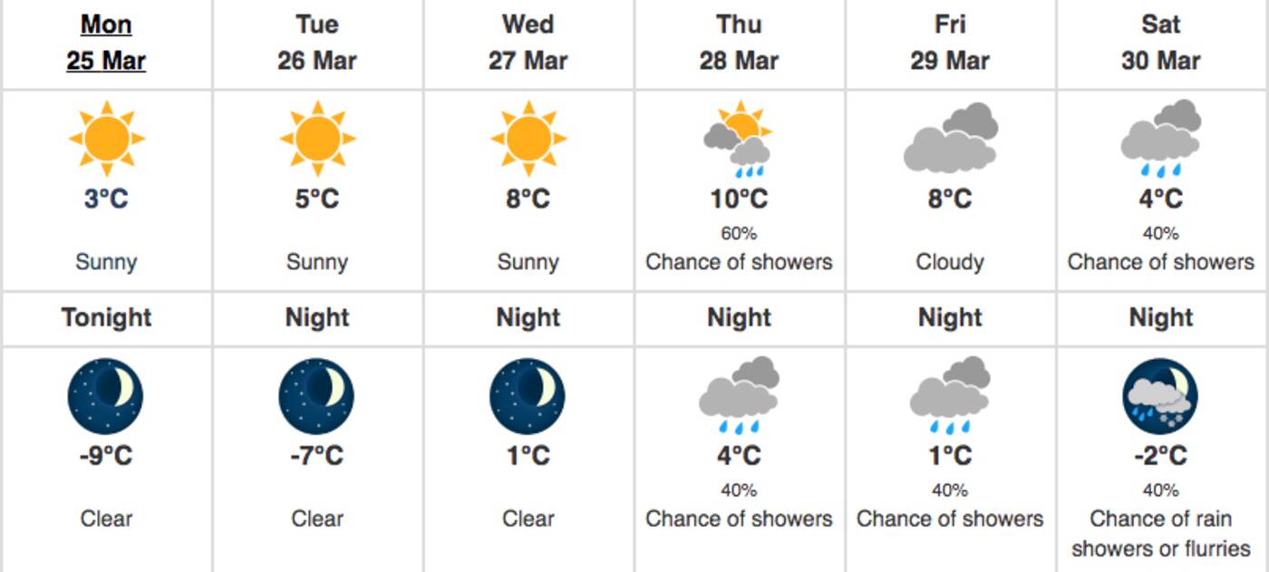
It feels like -9 C in the City of Toronto as of Monday morning, according to Environment Canada, dropping from a beautiful high of 9 C on Sunday afternoon.
Overnight, temperatures are expected to reach as low as -14 C with the windchill and Tuesday isn't a whole lot better with a low of -7 C.
Wednesday and Thursday should be nicer with highs of 8C and 10 C, respectively, though that glorious sun will disappear behind clouds by Thursday evening.

Toronto is in for another week of roller coaster temperatures. Image via Environment Canada.
Some typical, rainy, spring-like weather is in store for the end of the work week, though flurries could take over by Saturday night and continue into Sunday.
"The spring season will highlight its temperamental, transitional nature this week across southern Ontario, as we start shivering amid wind chills in the minus teens, but bask in afternoon highs in the teens by Thursday," wrote the Weather Network Monday morning, warning of a "wintry risk for the weekend."
"Colder than seasonal conditions are expected to persist into the start of April, although things look to take a turn for the warmer by the middle and end of next week."
In other words, you can expect both spring and winter weather conditions over the next few weeks in Toronto.
Dress accordingly, in layers.
by Lauren O'Neil via blogTO

No comments:
Post a Comment