The subject of what constitutes downtown for any major city can get people pretty riled up — especially so in a place like Toronto, where the boundaries are blurry and every hood is thirsty to be "world class" or whatever.
Documents released ahead of next week's Planning and Growth Management Committee meeting suggest that city officials now have their own, up-to-date classification system in this regard.
This should make things easier for winning arguments about whether or not one can rep for "The 6ix" (although that's more of a 905 thing, anyway) moving forward, but it doesn't.
At least not for the people of King West, Dundas West, West Queen West, Little Italy, Koreatown, Christie Pits, Ossington, Liberty Village or Parkdale.

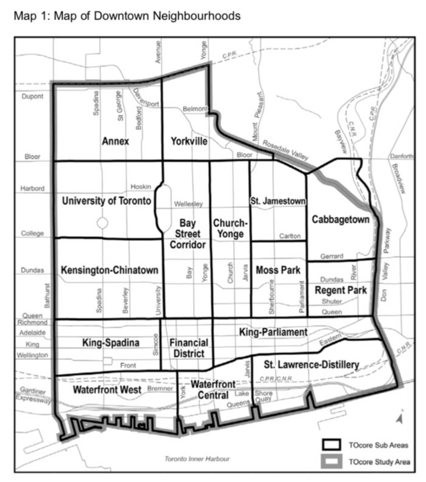
This map of downtown Toronto was included in reports set to go before a city committee on May 1. Image via Matt Elliott/City of Toronto.
Nothing west of Bathurst is considered to be "downtown" by the City of Toronto, according to a new map surfaced yesterday by Toronto journalist Matt Elliott.
Yorkville is cool though, apparently, even though it takes twice as long to get there from the CN Tower than it does from say, Trinity Bellwoods Park or even Exhibition Place.
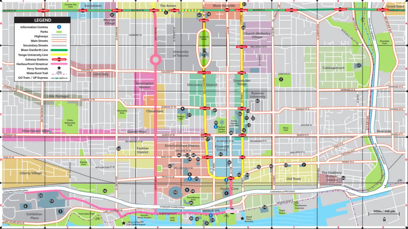
Tourism Toronto's map labels everything between Dufferin Street to Broadview Avenue as "downtown," but only up to Bloor, which seems to fit with what most people describe as the core in conversation.

Tourism Toronto's map of downtown includes is much wider and shorter than the city's newer version. Image via Tourism Toronto.
The TTC's map is even more generous with the east-west boundaries, which run from Lansdowne in the west to just past Broadview in the east.

As of 2018, the Toronto Transit Commission considers the boundaries of downtown to be Lansdowne, Bloor, Broadview and Lake Ontario.
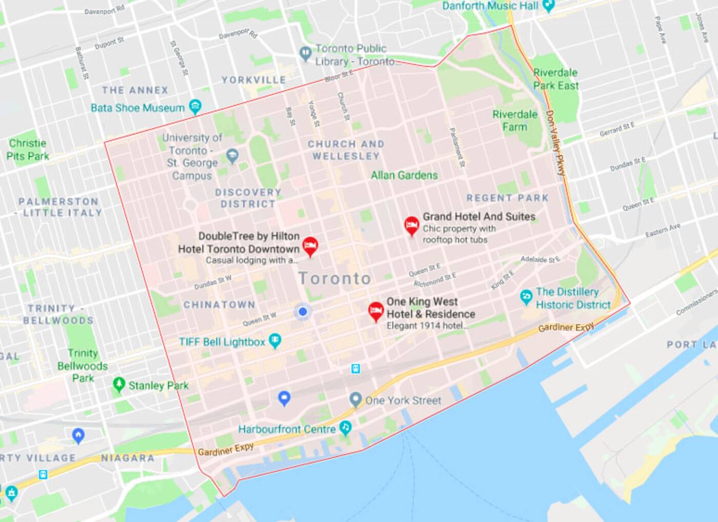
Google aligns with the city in terms of east-west borders, with Bathurst and the DVP flanking Toronto's downtown core.

Google has its own boundary system for the city's core. You can see it by searching for "Downtown Toronto" in Maps. Image via Google Maps.
Again, Yorkville and the Annex don't make the cut, probably because they're not actually downtown...unless you're the City of Toronto's Planning and Growth Management Committee.
Yeah, I'm bitter. But only because I'm right.
by Lauren O'Neil via blogTO

No comments:
Post a Comment